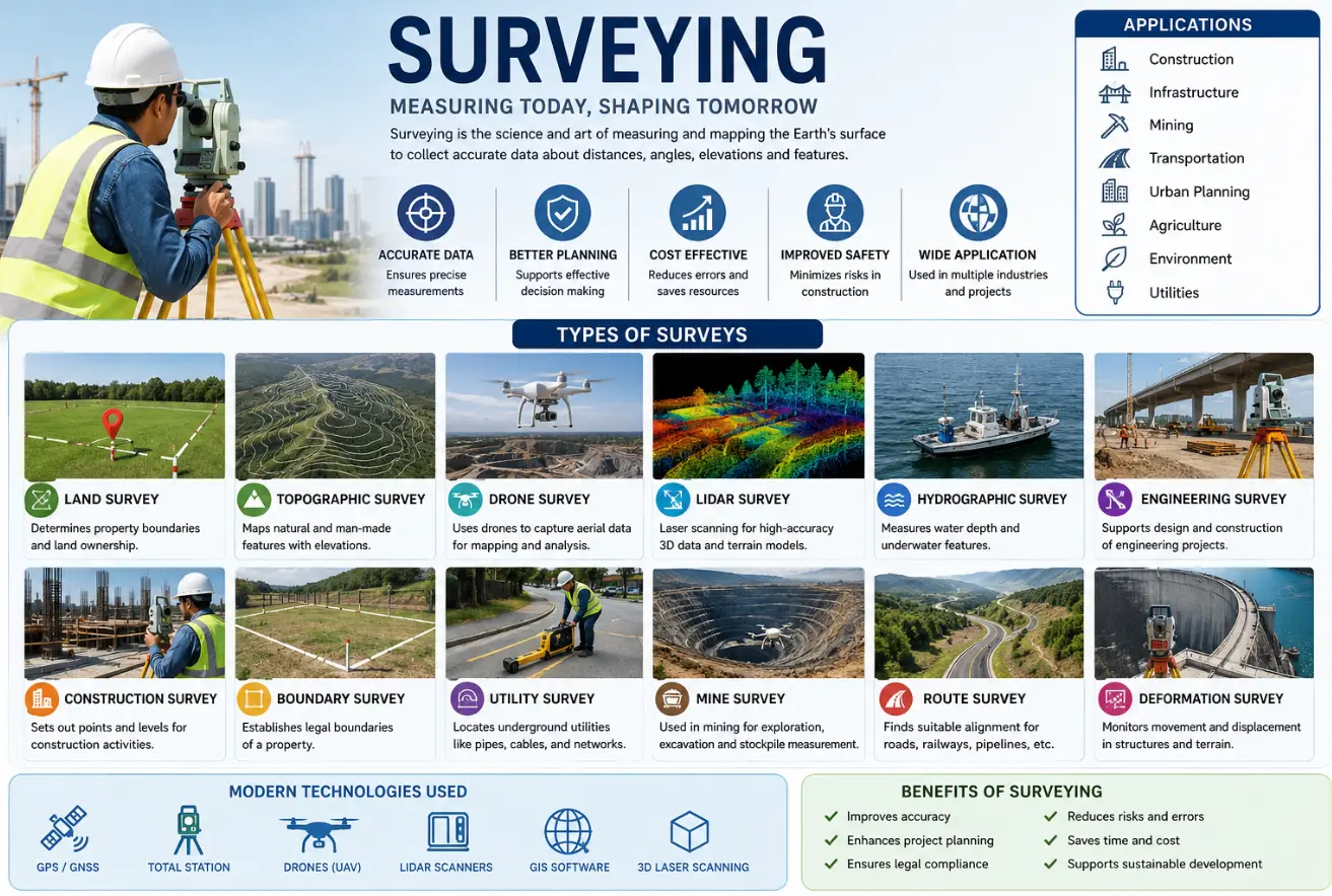
Surveying is an essential part of planning, designing, and developing infrastructure projects. It is the process of measuring and mapping land, structures, natural features, and other physical elements on the earth’s surface. Surveying provides accurate information about locations, distances, elevations, boundaries, and terrain conditions, helping engineers, architects, developers, and planners make informed decisions before starting any project.
From residential buildings and highways to industrial plants and smart cities, surveying plays a major role in every stage of development. Accurate survey data helps reduce construction errors, improve project planning, enhance safety, and ensure that projects are completed according to design requirements. Modern surveying has become more advanced with the use of technologies such as drones, GPS systems, GIS mapping, LiDAR scanning, and digital data processing.
Surveying is widely used in construction, transportation, mining, agriculture, urban planning, environmental management, and utility infrastructure. It helps identify land features, analyze terrain conditions, determine property boundaries, and support accurate project execution. Surveying also helps organizations save time and reduce costs by improving planning accuracy and minimizing project risks.
One of the most common forms of surveying is land surveying. Land surveys are conducted to measure land boundaries, determine property dimensions, and prepare legal land records. These surveys are important for property transactions, land development, and construction planning. Accurate land surveys help avoid disputes and ensure proper land utilization.
Topographic survey in Coimbatore
Topographic survey is another important type of survey that captures the natural and man-made features present on the land surface. It includes information about elevations, contours, roads, buildings, trees, drainage systems, and terrain variations. Topographic surveys are commonly used for infrastructure planning, road design, site development, and landscape projects.
Drone survey in Coimbatore
Drone surveying has become increasingly popular because it allows large areas to be surveyed quickly and efficiently. Drones equipped with cameras and sensors collect aerial data that can be used to create maps, 3D models, and site analysis reports. Drone surveys are widely used in construction, mining, agriculture, and infrastructure projects because they improve efficiency and reduce fieldwork time.
LiDAR survey is an advanced technology that uses laser scanning to create highly accurate three-dimensional models of land and structures. LiDAR surveys are useful for terrain mapping, corridor surveys, urban planning, and environmental studies. The technology provides detailed data even in difficult terrains and densely vegetated areas.
Hydrographic survey in Coimbatore
Hydrographic surveying is used to study underwater areas such as rivers, lakes, reservoirs, ports, and coastal regions. These surveys measure water depth, underwater terrain, and submerged features. Hydrographic surveys are important for marine construction, navigation, dredging, and water resource management.
Engineering Survey in Coimbatore
Engineering and construction surveys support the planning and execution of infrastructure projects. These surveys help establish accurate positions and levels for buildings, roads, bridges, pipelines, and other structures. Construction surveys ensure that projects are built according to approved designs and specifications.
Boundary survey in Coimbatore
Boundary surveys are conducted to identify and establish legal property lines. These surveys are important for land registration, property ownership verification, and resolving boundary disputes. Accurate boundary survey help maintain legal clarity and prevent conflicts.
Utility survey in Coimbatore
Utility survey are used to locate underground services such as water pipelines, gas lines, sewer systems, electrical cables, and communication networks. These surveys are essential before excavation and construction activities to avoid damage to existing infrastructure.
GIS mapping in Coimbatore
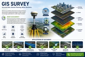
GIS mapping and spatial surveys help organize and analyze geographic information digitally. GIS technology is widely used in urban planning, environmental management, utility management, and smart city development. It allows organizations to visualize data and improve planning and decision-making processes.
Mining surveys in Coimbatore
Mining survey are conducted in mining areas to measure excavation zones, monitor stockpiles, and support resource management. These surveys improve operational efficiency and help maintain safety in mining operations.
Route survey in Coimbatore
Route surveys are commonly used for highways, railways, pipelines, canals, and transmission line projects. They help determine the most suitable alignment based on terrain conditions and project requirements.
Environmental survey in Coimbatore
Environmental survey help assess environmental conditions and support sustainable development practices. These surveys are used for environmental impact studies, ecological analysis, and resource management projects.
Modern surveying technologies have significantly improved the speed, accuracy, and efficiency of data collection. Tools such as GPS systems, total stations, drones, LiDAR scanners, and GIS software allow surveyors to collect and process large amounts of data with high precision. These technologies help improve project quality and reduce overall development costs.
Surveying continues to play a vital role in infrastructure growth and development across various industries. Accurate survey data supports better planning, safer construction, improved resource management, and efficient project execution. As technology continues to advance, surveying methods are becoming faster, smarter, and more reliable, making surveying an essential part of modern engineering and development projects.
Surveying is the foundation of successful infrastructure and land development. Different types of surveys provide valuable information required for planning, design, construction, and management. Whether it is land surveying, topographic surveying, drone mapping, hydrographic surveying, or utility mapping, each survey contributes to accurate decision-making and efficient project delivery. Modern surveying technologies continue to transform the industry, helping organizations achieve better accuracy, productivity, and long-term project success.