A GIS survey plays a vital role in modern engineering, infrastructure development, and land management by converting geographic information into intelligent digital maps. Unlike traditional surveys that focus only on measurements, GIS (Geographic Information System) surveys combine field data with spatial analysis to help engineers, planners, and developers make informed decisions.
What is a GIS Survey?
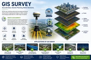
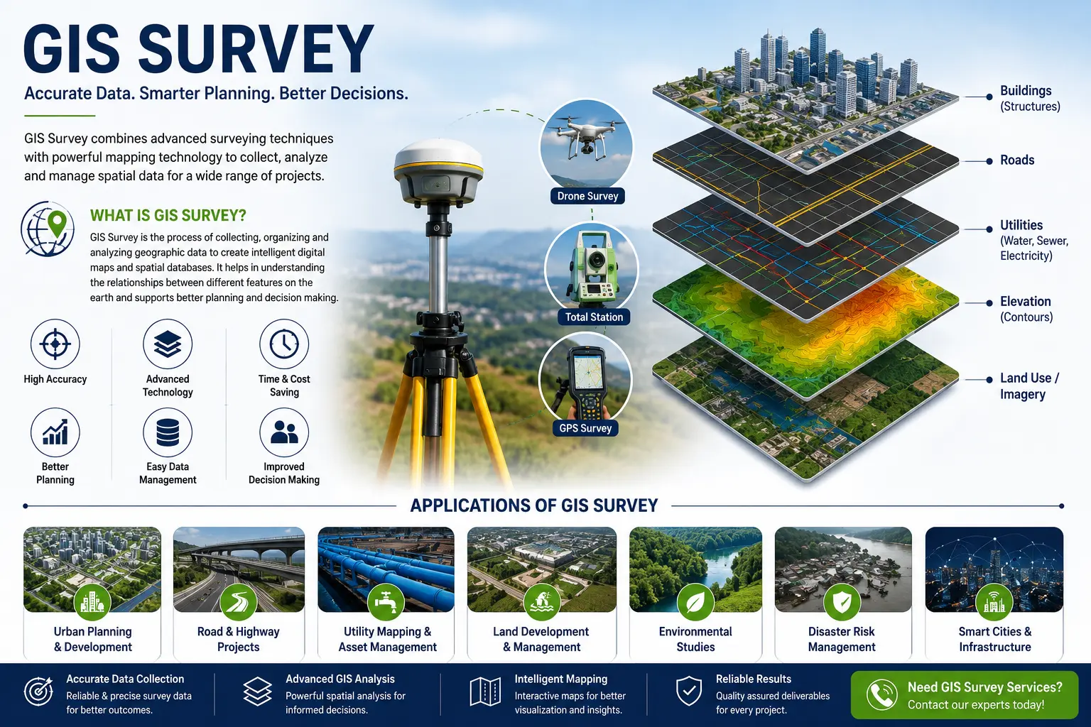
A GIS survey is the process of collecting, organizing, and analyzing geographic data to create digital maps and spatial databases. It captures the exact location of physical features such as roads, buildings, utilities, water bodies, and land boundaries while storing additional information about each feature.
The collected data is integrated into GIS software, allowing users to visualize, update, and analyze information through interactive maps. This makes it easier to understand existing site conditions, identify potential challenges, and plan future developments with confidence.
GIS surveys are commonly carried out using advanced technologies such as GPS/GNSS receivers, drones, LiDAR, total stations, and satellite imagery to ensure accurate and reliable results.
Why is GIS Survey Important?
Every construction or infrastructure project relies on accurate geographic information. Incomplete or outdated data can lead to planning errors, project delays, and increased costs. A GIS survey helps eliminate these issues by providing a centralized digital database that can be easily accessed and updated.
With GIS, engineers can analyze land features, utility networks, transportation systems, and environmental conditions before construction begins. This enables better coordination between different project teams and supports faster, data-driven decision-making.
Applications of GIS Survey
GIS surveys are widely used across various industries because they provide accurate and organized spatial information.
In urban planning, GIS helps planners design road networks, residential layouts, public facilities, and smart city infrastructure based on existing land conditions.
For road and highway projects, GIS supports route planning, corridor mapping, traffic studies, and infrastructure management by providing detailed geographic data.
Utility companies use GIS surveys to map water supply pipelines, sewerage systems, stormwater drains, electrical cables, gas pipelines, and communication networks. Having this information in a digital format simplifies maintenance and future expansion.
In land development, GIS assists developers in understanding property boundaries, terrain, drainage patterns, and existing infrastructure before construction begins.
GIS surveys also play a significant role in environmental studies, where they help monitor forests, water resources, wetlands, and environmentally sensitive areas. This information supports sustainable planning and regulatory compliance.
Benefits of GIS Survey
One of the biggest advantages of a GIS survey is its ability to improve decision-making through accurate and organized geographic information. Interactive digital maps allow project teams to visualize data clearly and identify potential issues before construction starts.
GIS surveys also increase project efficiency by reducing manual data handling and simplifying collaboration between engineers, architects, planners, and contractors. Since all spatial information is stored in a centralized database, updates can be made quickly without repeating the entire survey.
Other key benefits include:
- Accurate digital mapping
- Better project planning
- Improved utility and asset management
- Faster data sharing across teams
- Reduced project risks and costs
- Easy integration with CAD and BIM workflows
- Long-term management of infrastructure assets
By providing reliable geospatial information, GIS surveys help organizations complete projects more efficiently while minimizing costly errors.
Why Choose Suncon Engineers for GIS Survey?
At Suncon Engineers, we provide professional GIS survey services using advanced surveying equipment and modern geospatial technologies. Our experienced team collects accurate field data and develops customized GIS databases that support infrastructure planning, land development, utility mapping, and engineering projects.
We focus on delivering reliable spatial information that helps clients improve planning, manage assets efficiently, and make informed project decisions. Whether your project involves transportation, utilities, industrial development, or urban planning, our GIS survey solutions are tailored to meet your specific requirements.
Need accurate GIS survey services for your next project? Contact Suncon Engineers today to discuss your requirements and receive expert guidance.
A GIS survey is much more than creating digital maps it provides the accurate spatial information needed for smarter planning, efficient project execution, and long-term asset management. By combining advanced surveying techniques with GIS technology, organizations can reduce risks, improve decision-making, and build sustainable infrastructure with confidence.
Frequently Asked Questions
What is a GIS survey?
A GIS survey collects and organizes geographic data to create accurate digital maps and spatial databases.
Where is GIS surveying used?
GIS surveying is used in infrastructure development, utility mapping, urban planning, transportation, and land development projects.
What equipment is used in a GIS survey?
GPS/GNSS receivers, drones, LiDAR, total stations, and GIS software are commonly used for GIS surveys.
What are the benefits of GIS surveying?
GIS surveying improves mapping accuracy, supports better planning, simplifies asset management, and reduces project costs.
How does GIS differ from traditional surveying?
Traditional surveying measure’s locations, while GIS organizes, analyses, and visualizes survey data to support planning and decision-making.