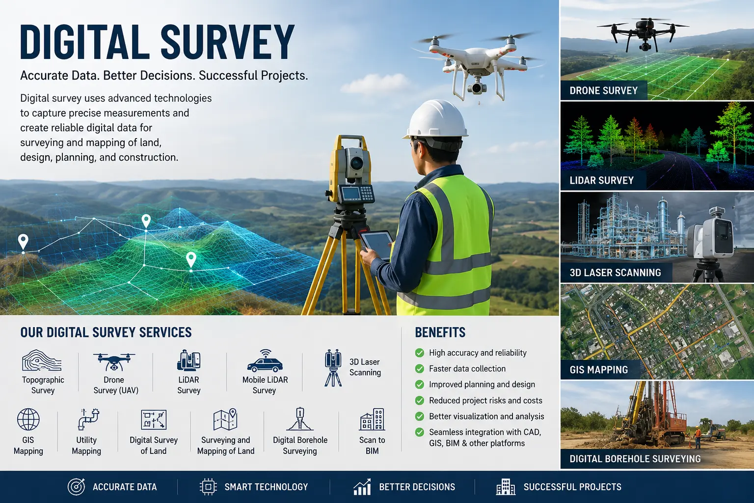
Digital Survey has transformed the way land, infrastructure, and construction projects are planned and executed. As engineering projects become increasingly complex, the demand for precise and reliable survey data has grown significantly. Modern digital surveying technologies provide accurate measurements, detailed mapping, and comprehensive spatial information that support better planning, design, construction, and asset management.
From surveying and mapping of land to infrastructure development, utility planning, and industrial projects, digital surveys help engineers, architects, developers, government agencies, and landowners make informed decisions based on highly accurate data. Compared to conventional surveying methods, digital surveys offer greater efficiency, faster data collection, improved accuracy, and seamless integration with modern engineering software.
What is a Digital Survey?
A Digital Survey is the process of collecting, measuring, and mapping land and existing physical features using advanced electronic surveying equipment and digital technologies. The collected data is processed into digital formats that can be used for engineering design, planning, GIS applications, BIM workflows, construction management, and long-term asset maintenance.
Digital surveying is also widely used for the surveying and mapping of land, providing accurate digital representations of property boundaries, terrain, natural features, utilities, roads, buildings, and other important site information. This enables project teams to make confident decisions while reducing errors and project risks.
Digital Survey of Land
A digital survey of land is one of the most important steps before starting any residential, commercial, industrial, or infrastructure project. It provides an accurate understanding of existing land conditions, ensuring that every stage of planning and design is based on reliable information.
Digital land surveys are commonly used for:
- Land boundary surveys
- Surveying and mapping of land
- Topographic mapping
- Land subdivision
- Site development planning
- Infrastructure corridor planning
- Utility mapping
- Earthwork quantity calculations
- Road and drainage planning
- Property documentation
Digital Borehole Surveying
Digital borehole surveying is used to determine the precise location, depth, and orientation of boreholes during geotechnical investigations, groundwater exploration, mining operations, and infrastructure development. Using advanced digital instruments, engineers can obtain reliable subsurface information that supports foundation design, geological studies, tunnel construction, and underground utility planning.
Digital borehole surveying improves the quality of geotechnical investigations, minimizes uncertainty, and provides valuable information for safe and efficient engineering design.
Importance of Digital Survey
Reliable survey data is the foundation of every successful engineering project. Even small inaccuracies during the survey stage can lead to design errors, construction delays, increased costs, and operational challenges.
Digital Survey offers several advantages, including:
- High-precision measurements
- Faster field data collection
- Improved planning accuracy
- Better engineering decisions
- Reduced project risks
- Efficient project coordination
- Reliable digital documentation
- Easy integration with CAD, GIS, BIM, and Digital Twin platforms
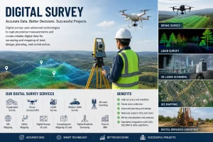
Digital Survey Services
Digital surveying includes a wide range of specialized services depending on project requirements.
- Topographic Survey: Captures contours, elevations, existing structures, roads, vegetation, drainage systems, and utilities to support engineering design and land development.
- Drone Survey (UAV Survey): Uses unmanned aerial vehicles to rapidly collect aerial imagery and terrain data for large land parcels, infrastructure corridors, mining sites, and industrial developments.
- LiDAR Survey: Laser scanning technology captures millions of accurate measurements to create highly detailed three-dimensional models for engineering analysis and mapping.
- Mobile LiDAR Survey: Collects accurate road and corridor information using vehicle-mounted laser scanning systems, making it ideal for highways, railways, and urban infrastructure projects.
- 3D Laser Scanning: Produces detailed digital models of buildings, industrial plants, bridges, heritage structures, and other complex facilities.
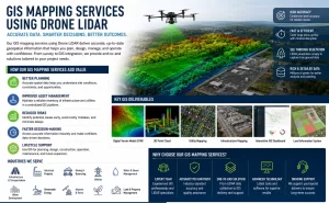
- GIS Mapping: Organizes survey data into Geographic Information Systems for land management, utility planning, environmental studies, and infrastructure asset management.
- Utility Mapping: Locates and maps underground and above-ground utilities to improve project safety and reduce construction conflicts.
- Scan to BIM: Converts point cloud data into intelligent Building Information Models for renovation, facility management, and Digital Twin applications.
Applications of Digital Survey
Digital Survey supports a wide variety of industries and development projects, including:
- Surveying and mapping of land
- Residential and commercial developments
- Industrial projects
- Smart city developments
- Roads and highways
- Railways and metro systems
- Airports
- Water supply projects
- Sewerage systems
- Stormwater drainage networks
- Bridges and flyovers
- Utility corridors
- Renewable energy projects
- Mining and quarry development
- Environmental studies
- Urban and regional planning
Benefits of Digital Survey
Modern digital surveying provides numerous benefits over traditional survey methods.
Some of the major advantages include:
- High accuracy and reliability
- Faster project completion
- Reduced manual errors
- Better visualization through digital models
- Improved project planning
- Enhanced collaboration among stakeholders
- Lower construction costs through accurate planning
- Better documentation for future maintenance
- Seamless integration with engineering software
- Support for BIM and GIS-based workflows
Why Choosing a Digital Survey Company
Selecting an experienced digital survey company is essential for obtaining accurate and dependable survey results. A professional survey company combines advanced equipment, experienced surveyors, modern software, and quality assurance processes to deliver reliable spatial information for projects of all sizes.
When selecting a digital survey company, consider factors such as technical expertise, modern surveying technology, project experience, quality standards, timely delivery, and the ability to provide CAD, GIS, BIM, and Digital Twin-ready data.
The Future of Digital Surveying
Emerging technologies such as drones, LiDAR, artificial intelligence, cloud computing, and Digital Twins are redefining digital surveying. These innovations enable faster data processing, real-time collaboration, improved visualization, and more accurate decision-making throughout the project lifecycle.
As infrastructure and urban development continue to expand, digital surveying will play an increasingly important role in delivering efficient, sustainable, and data-driven engineering solutions.
Digital Survey has become an indispensable part of modern engineering, infrastructure, and land development projects. Whether it is a digital survey of land, surveying and mapping of land, or digital borehole surveying, accurate digital survey data provides the foundation for successful planning, design, and construction.
Working with an experienced digital survey company ensures access to advanced surveying technologies, reliable spatial data, and professional expertise that help reduce risks, improve project efficiency, and support better decision-making. As digital technologies continue to evolve, digital surveying will remain a key driver of innovation across the engineering, construction, and infrastructure sectors.
Digital survey Kerala | Digital survey machine | Digital survey in Coimbatore | Digital survey Trivandrum | Digital survey of land in Bangalore | Digital survey of land in Hyderabad | best Digital survey in Kerala | Digital survey by drone | Digital survey Chennai | Digital survey in Trivandrum | Digital survey Kayamkulam | Digital survey of land in Andhra Pradesh | Digital survey of land Kerala | Digital survey of land Visakhapatnam | Digital survey of land Visakhapatnam phone number | Digital survey of lands in Hyderabad | Digital surveyors in Thiruvalla | Digital surveying & mapping