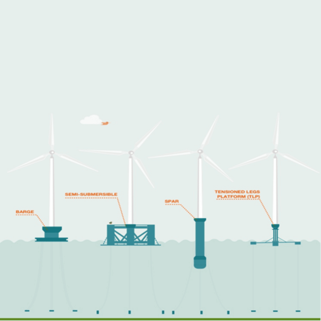
Offshore wind energy: the decarbonised innovative approach to use renewable sources
With the step-in movement in green and sustainable planet and increased use of energy due to globalisation and technology, world […]
With the step-in movement in green and sustainable planet and increased use of energy due to globalisation and technology, world […]

As we all know that in India, we are undergoing a lot of development and along with the other developments

In the day-to-day life of a commoner, traffic and the issues related to it, has become an inseparable part of
As we all know, India is a growing and rapidly developing country, and along with the other infrastructures, it is

India is a developing country as compared to other nations, on its verge to be a developed country, India is
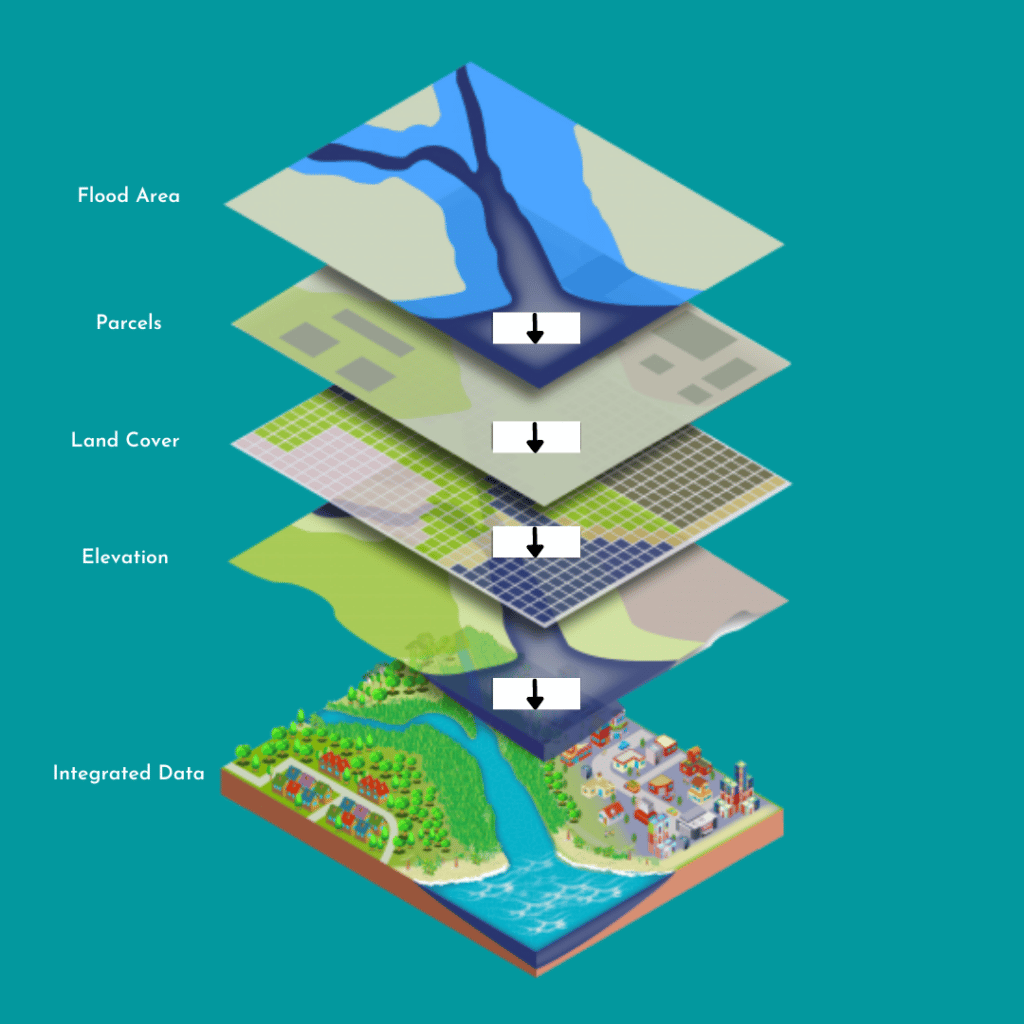
Geographic information system (GIS), as we all know, is a computer-based system for capturing, storing, checking, and displaying data related to positions
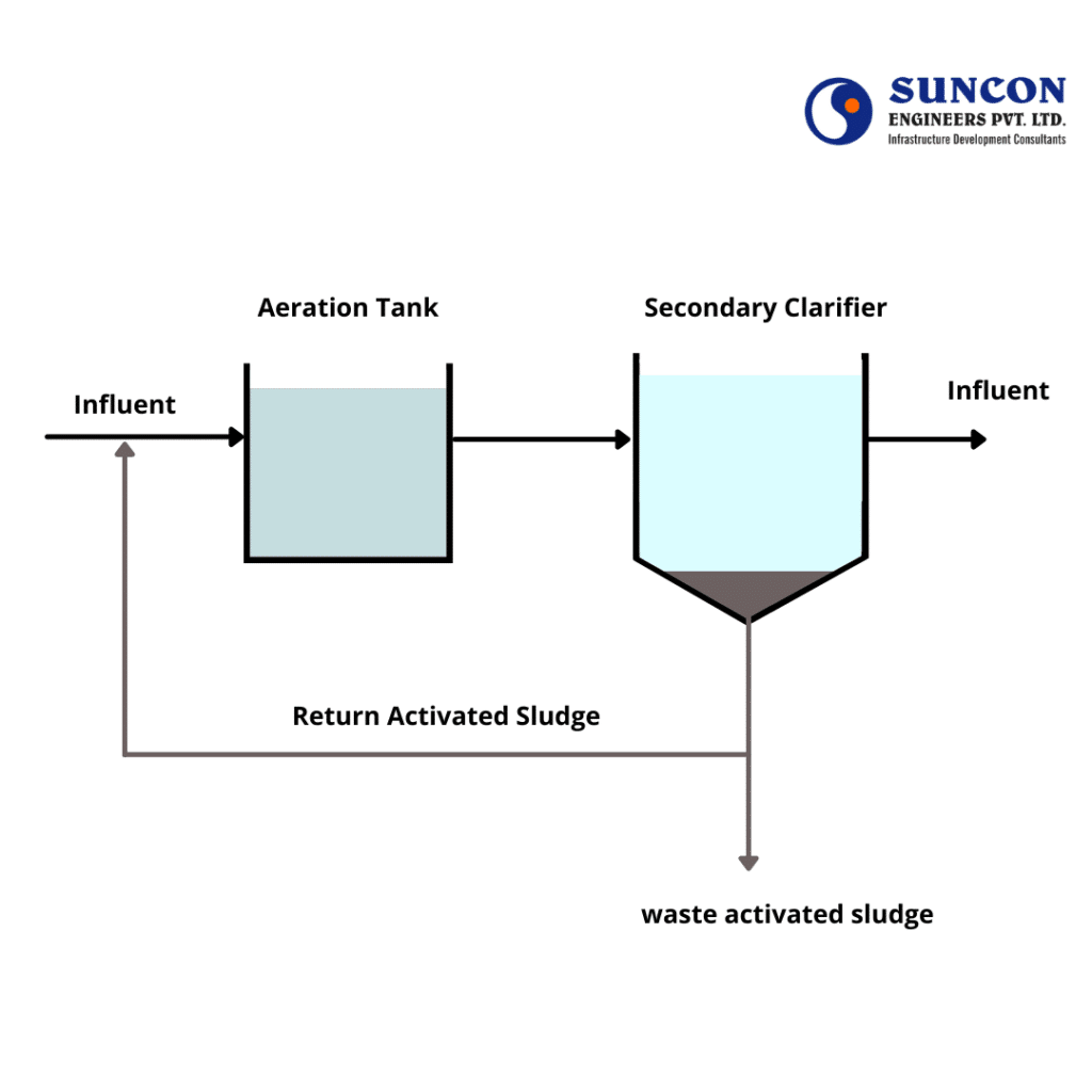
An Activated Sludge Process (ASP) system commonly includes an aeration tank and a secondary clarifier. The first is used for biological degradation and the other is used to separate sludge from
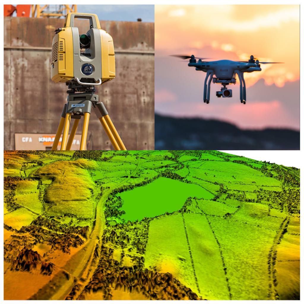
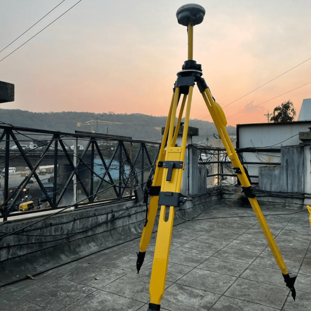
Survey of India is established in 1767 which is 252 years ago. In this long period survey has achieved advance technology. In the initial period dumpy levels, theodolites and chain were used. Dedication and hard work surveyors and engineers have achieved a lot through these instruments. Pune-Mumbai Railway line has several tunnels and these are completed with survey instruments like theodolite and dumpy levels. Over period of time, technology evolved to find out distometer launched on theodolite and auto level. It was joyful for engineers and surveyors to complete survey work without tape. Further to that total station instrument and digital level made atomization in the instrument. For global location DGPS (Differential Global Positioning System) was used. DGPS : Differential Global Positioning Systems (DGPS) are enhancements to the Global Positioning System(GPS) which provide improved location accuracy, in the range of operations of each system, from the 15-meter nominal GPS accuracy to about 10 cm in case of the best implementations. The DGPS Survey main features are: ● Position is determined by distance from at least 4 satellites. ● Time taken by signal to travel from satellite to antenna used to determine the distance. ●