
A topographical survey (often called a “topo survey”) is a detailed study of land features, including elevation changes, vegetation, buildings, and other site characteristics. Using advanced tools like GPS, drones, and laser scanners, Topographical surveyors create accurate maps and 3D models that help project teams make informed decisions.
Topographical surveys are essential tools in the world of land development, construction, and urban planning. These detailed maps provide key information about the terrain, elevation changes, and both natural and man-made features of a given area. In this comprehensive guide, we’ll explore the various aspects of topographical surveys, including methodology, key players, and applications.
What is Topographical Survey Research Methodology and Technology
- Global Positioning Systems (GPS): Used to determine precise coordinates of surveyed points.
- Electronic Distance Measurement (EDM): Allows surveyors to measure distances with high accuracy.
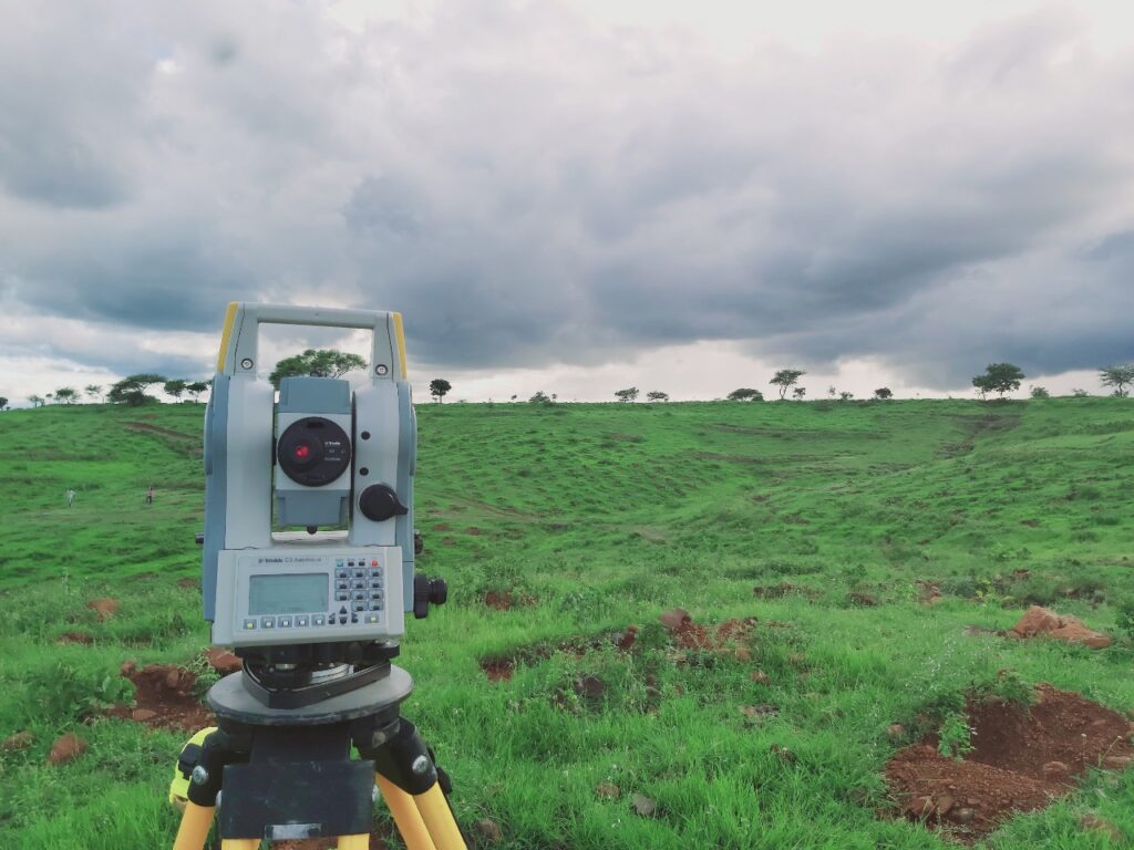
- Total Station Theodolite (TST): Combines angle and distance measurements for precise positioning.
- LiDAR: Laser-based technology that can achieve accuracies of ±0.004 feet (1.2 mm) or better.
- 3D Laser Scanners: Used for creating detailed 3D models of complex structures and terrain.
How is a Topographical Survey Conducted?
- Planning & Preparation: Understanding project needs and selecting the right tools.
- Field Data Collection: Using GPS, drones, total stations, and other technology to gather precise measurements.
- Data Processing & Analysis: Converting raw data into usable maps and 3D models with specialized software.
- Creating Topographical Survey Reports & Drawings: Generating contour maps, elevation models, and site plans.
- Final Review & Delivery: Ensuring data accuracy before handing over results to clients.
Why is a Topographical Survey Important?
- Urban and Rural Development: Helps in designing residential areas, industrial zones, and commercial spaces.
- Construction Projects: Ensures accurate site measurements, reducing costly errors and delays.
- Infrastructure Planning: Supports road, bridge, and railway construction by identifying potential challenges.
- Environmental Protection: Assists in flood risk assessments, conservation planning, and sustainable land use.
What Does a Topographical Survey Provide?
- Detailed Report: Summaries of site conditions and measurements.
- Site Maps & Drawings: CAD-based representations showing land elevations, slopes, and structures.
- Digital Terrain Models (DTMs): 3D renderings for better visualization.
- Geospatial Data: GIS-compatible datasets for further analysis.
These deliverables are essential for:
- Architects and engineers in the design phase
- Construction companies for site planning
- Environmental assessments and impact studies
- Urban planners for development projects.
Topographical surveys are utilized across various sectors:
- Construction: For site planning and design of buildings, roads, and infrastructure.
- Urban Planning: To inform decisions about land use and development.
- Environmental Studies: For assessing natural features and potential impacts.
- Transportation: In the highways design, railways, and airports.
- Mining and Quarrying: For volume calculations and site management.
Advanced Technology in Topographical Surveying
Modern topographical surveying has significantly evolved with the integration of advanced technologies, enhancing accuracy, efficiency, and data collection capabilities. One of the most transformative innovations is LiDAR (Light Detection and Ranging), which uses laser pulses to create highly detailed 3D models of the terrain, even penetrating vegetation to capture ground elevation beneath dense forests. Drone-based photogrammetry has also revolutionized surveying, enabling high-resolution aerial imagery and 3D mapping at a fraction of the time and cost compared to traditional methods. GPS (Global Positioning System) and GNSS (Global Navigation Satellite System) allow surveyors to achieve centimetre-level accuracy in real-time, streamlining field data collection. Total Stations, equipped with robotic automation and laser scanning capabilities, further enhance precision by measuring distances, angles, and elevations with minimal manual intervention. Additionally, GIS (Geographic Information Systems) plays a crucial role in processing and analyzing topographical data, integrating spatial information for advanced mapping and decision-making. These cutting-edge technologies not only improve the speed and accuracy of topographical surveys but also make it easier to model landscapes for engineering, urban planning, and environmental monitoring applications.
Why Choose Us?
Our team of experienced (26+ year) Topographical surveyors is dedicated to providing accurate and reliable data, using the latest technology to ensure the highest standards of precision in PAN India. We offer a comprehensive range of surveying services, from initial site analysis to final reporting, making sure that every aspect of your project is covered. With a client-cantered approach, we prioritize clear communication and tailor our solutions to meet the unique needs of each project, ensuring smooth and successful execution every time.
Why Choose Us for Your Topographical Survey Needs?
Choosing the right surveying company is crucial for ensuring accuracy, efficiency, and reliability in your project. Here’s why we stand out:
✅ Precision & Accuracy – We use cutting-edge technology, including LiDAR, GPS, drone survey, and total stations, to deliver highly accurate topographical data.
✅ Experienced Professionals – Our team consists of certified and highly skilled surveyors with years of experience in land surveying and mapping.
✅ Comprehensive Survey Solutions – From site analysis to detailed mapping, we provide full-scale topographical surveys tailored to your project needs.
✅ Fast & Efficient Service – We prioritize quick turnaround times without compromising quality, ensuring your project stays on schedule.
✅ Custom Reports & Deliverables – We provide topographical maps, CAD drawings, 3D models, and GIS-integrated data, customized to suit architects, engineers, and developers.
✅ Compliance & Industry Standards – Our surveys meet legal, engineering, and environmental standards, ensuring your project is built on a solid foundation.
✅ Cost-Effective Solutions – We offer competitive pricing while delivering exceptional value, making high-quality surveying accessible to all project sizes.
✅ Nationwide & Local Expertise – Whether your project is in urban, rural, or remote areas, we have the expertise to handle diverse terrains and conditions.
Frequently Asked Questions:
- What is a topographical survey?
A topographical survey is a detailed mapping of natural and man-made features on a specific piece of land. It captures elevations, contours, and physical features such as buildings, trees, roads, and drainage systems.
- Why is a topographical survey important?
Topographical surveys are crucial for planning, design, and construction projects. They help engineers, architects, and developers understand the land’s physical characteristics and avoid potential issues.
- How much does a topographical survey cost?
Costs vary based on land size, location, detail level, and survey methods used. A basic survey might start from a few hundred dollars, while larger or more detailed surveys can cost thousands.


