Civil Engineering Consulting Services in Coimbatore | Survey, LiDAR & GIS Surveys
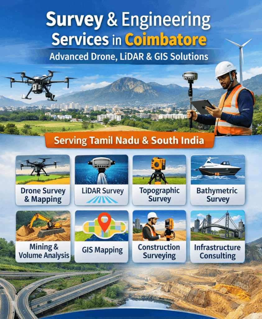
Delivering high-quality surveying and engineering consulting services across India, we are proud to expand our operations with a new branch […]
Delivering high-quality surveying and engineering consulting services across India, we are proud to expand our operations with a new branch […]
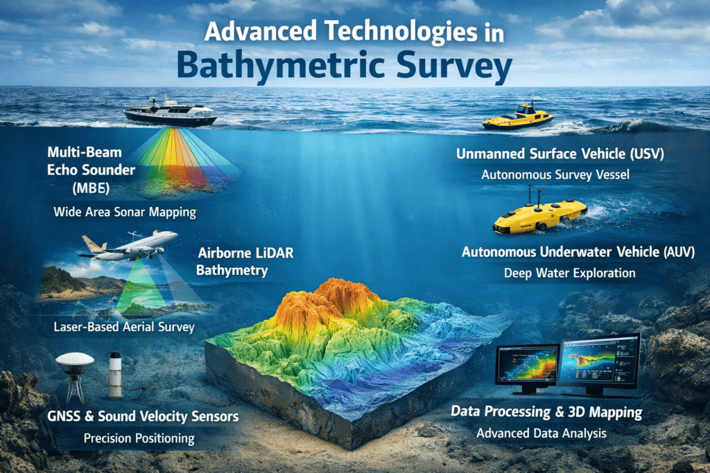
Bathymetric surveys are used to measure the depth and shape of underwater surfaces in rivers, lakes, reservoirs, coastal areas, and
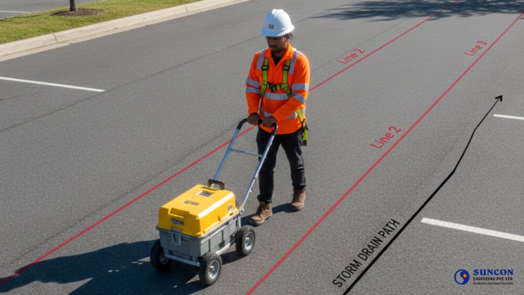
When we talk about modern construction, safety, and planning, one term that keeps coming up is Utility Detection Survey. Whether
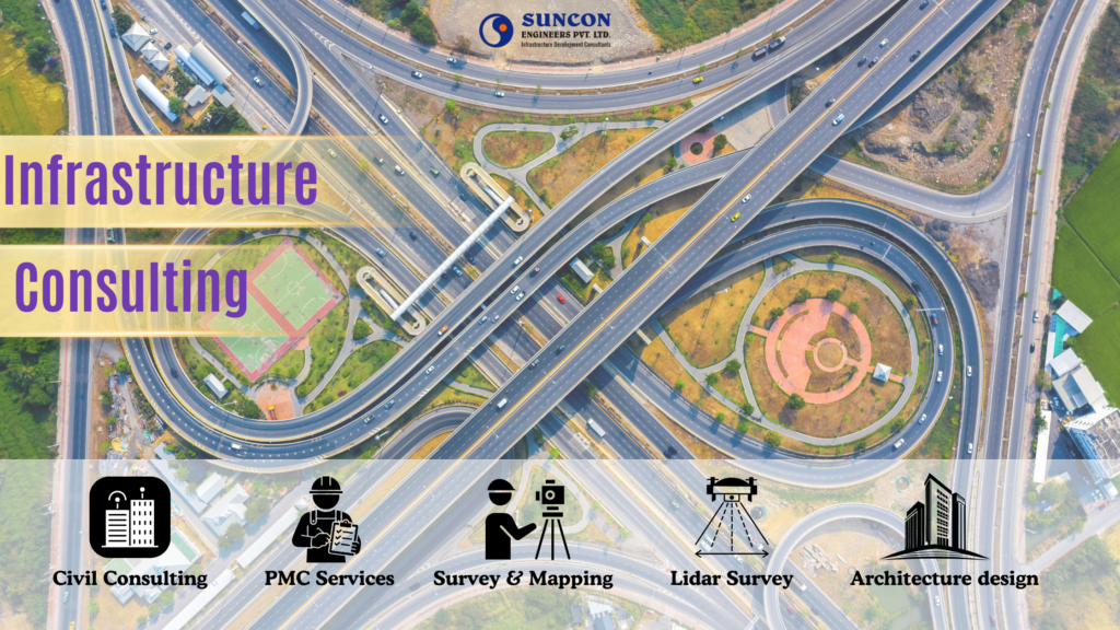
In the world’s rapidly expanding civil and construction landscape, Infrastructure Consultants play a mission-critical role in shaping sustainable, efficient, and
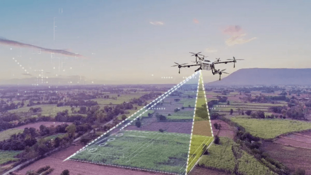
Surveying and geospatial engineering, photogrammetric survey stands out as one of the most advanced and efficient methods of capturing accurate

A tree/vegetation survey is a scientific way to record, study, and map the plants and trees in a certain area.

Geophysical Survey is one of the most advanced and non-destructive techniques used to study the physical characteristics of the Earth’s
What is a Flood Risk Survey? A flood risk assessment, also known as a flood risk survey, is a thorough

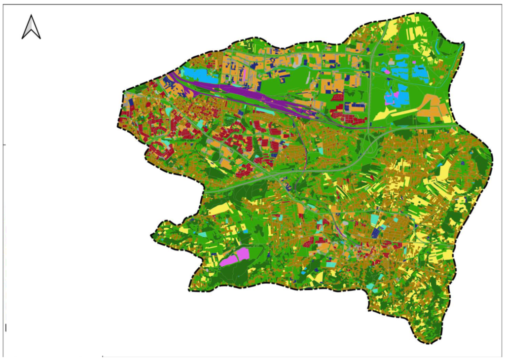
Urbanization is transforming cities across the world bringing better infrastructure, housing, and economic growth. But with this growth comes one

Mobile LiDAR (Light Detection and Ranging) is an advanced, vehicle-mounted laser scanning system designed to capture high-density 3D point cloud

A geological survey is a systematic study of the Earth’s structure, composition, and natural resources. It involves the collection, analysis,
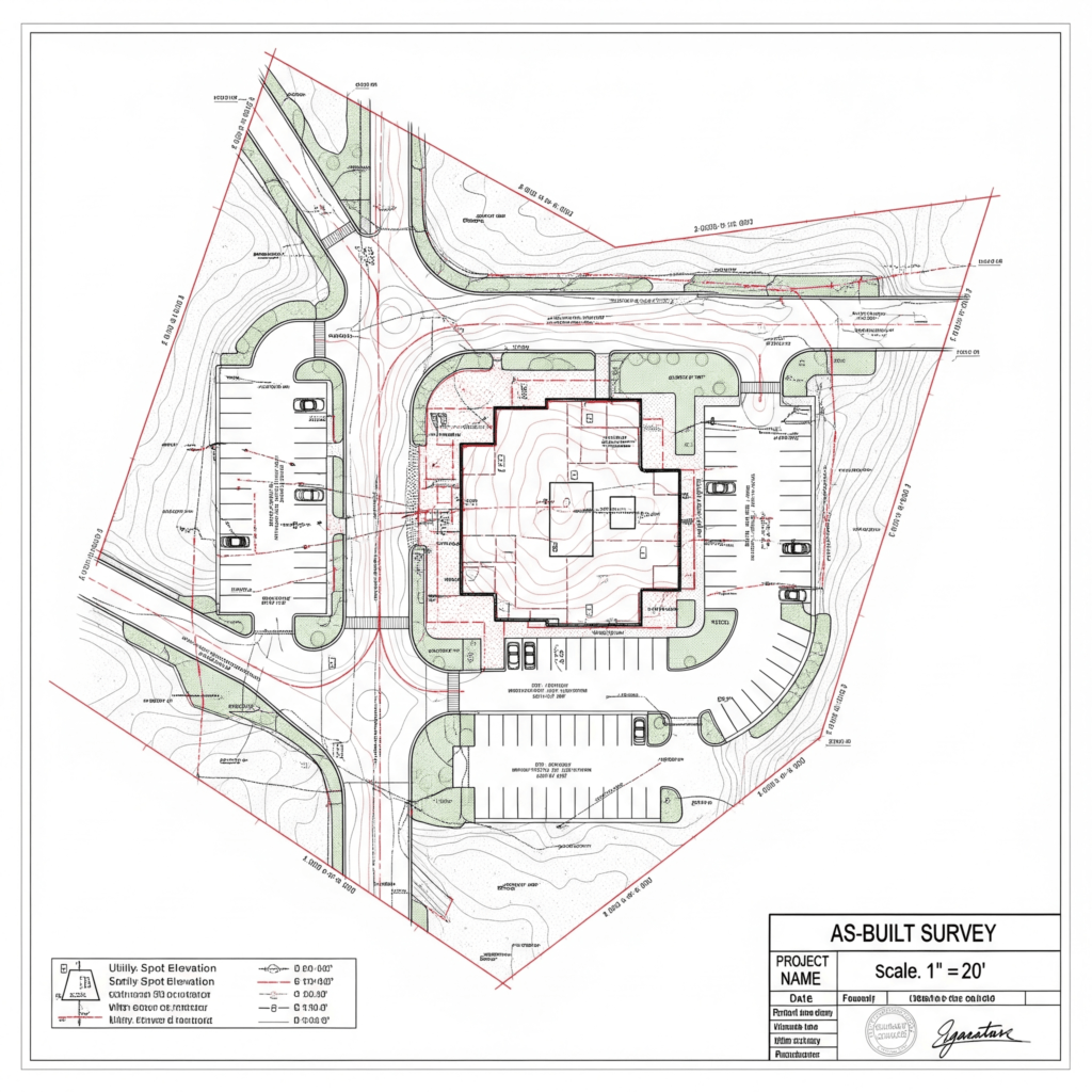
What is an as-built survey? An as-built survey is a detailed documentation of a project’s final, constructed conditions. Unlike initial

A transmission line survey is the most crucial stage before the construction of high-voltage power lines. The survey ensures that
Surveying is the backbone of modern engineering, construction, and infrastructure development. From roads and bridges to buildings and utilities, every

Bathymetric surveys help us understand underwater terrain by measuring the depth and shape of riverbeds, lakes, reservoirs, and coastal zones.