Scope of Work:
- Total station survey/ Theodolite Survey (Topographical Survey including bathymetry of 2 ponds) to generate 1 meter’s contour interval for 2 existing ponds having catchment area of 0.6 km2.
- Measuring ponds dimensions including the depth also (bathymetry).
- Dead and Live storage capacity of the ponds.
- 8 survey points on depth to water (Depth to water) table around each pond (10 m away and within 50 m radially from the edge of the pond in all 4 directions) along with geotags of Depth to water table points taken (As we have 2 ponds, 4 points each and 8 points in total).
- Identifying the LULC class where the topographic survey points will be conducted.
- Water quality analysis
Classification of Work:
- Part 1 – Total Station Survey / DGPS
- Part 2 – Bathymetric Survey
- Part 3 – Water Quality-Analysis
Part 1 – Total Station Survey / DGPS Survey
- Conducting spot level survey with 10/10 meter Grid / intervals
- Contours 0.5 & 1 meter of intervals
- Taking all the details of drains, road, land, power lines and other details based on site.
Part 2 – Work Methodology of Eco Sounder
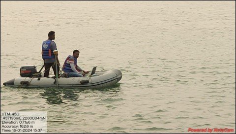
- STEP 1 – Fixing TBM on the embankment or bank of the lake (Either side Right or Left) at every 200m interval on an existing permanent structure.(Bathymetric survey using single beam single frequency (210 Khz) using Hydro Box HD 210 KHz)
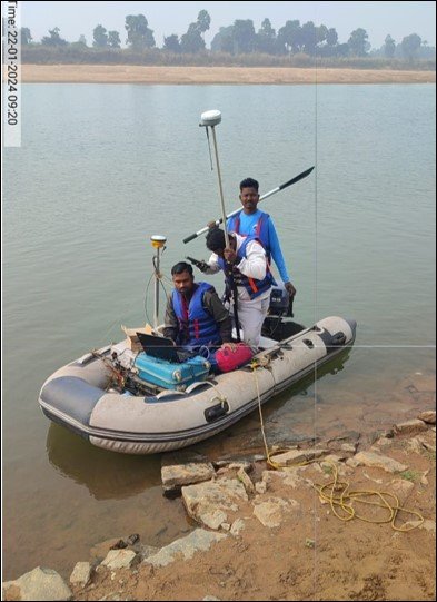
- STEP 2 – Mounting Eco sounder (Hydro box HD 210 KHz Single beam Single frequency) on survey boat with SP 461 dual frequency GNSS receiver for Positioning.
Work Methodology of Eco Sounder
- STEP 3 – Using EIVA Data acquisition and processing software we can acquire Eco sounder data in real-time and also acquire the position of every eco data using the GNSS receiver.
- STEP 4 – Aer the acquisition of eco-sounder data now we can process data using EIVA software. Finally, we get a CSV file having Easting(X), Northing (Y), and depth below the water surface (Z)
Work Methodology of Eco Sounder
- STEP 4 – During the eco sounder survey water level will be taken with respect to the existing TBM so final data will be reduced with respect to water level.
- Step-5 – Total station survey/ Theodolite Survey to generate 1 meter’s contour interval for 2 existing ponds having catchment area of 0.6 km2.
- Part 3- Sample collection of Waters and quality analysis with NABL accredited Lab.