Suncon Engineers has successfully conducted a high-precision LiDAR (Light Detection and Ranging) survey to capture detailed topographic data of the designated area. This advanced geospatial technology enabled us to generate accurate 3D models, digital elevation models (DEMs), and contour maps essential for engineering, infrastructure planning, and environmental analysis.
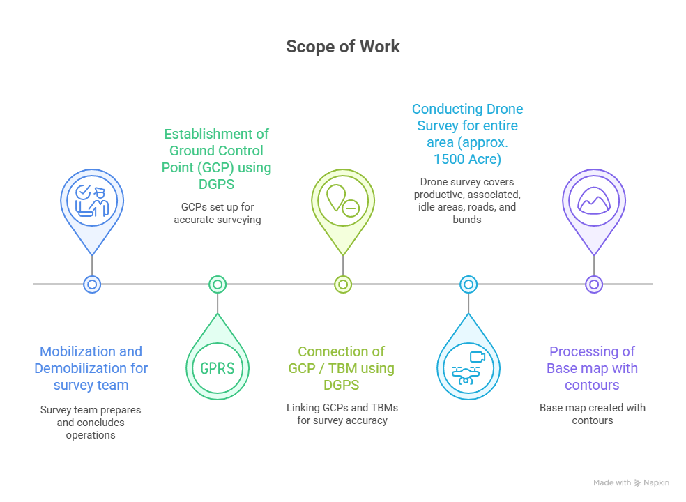
Scope of Work:
- Establishment and connection of Ground Control Point (GCP) using DGPS.
- Conducting Drone Survey for entire area (approx. 1500 Acre)
– Productive area (Block wise)
– Associated area with Production
– Idle Area
– Road and Bunds
- Processing of Base map with contours
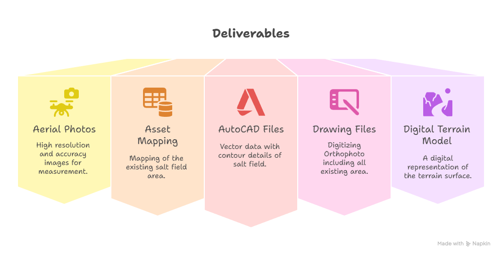
Deliverables:
Deliverables under the Lidar Drone Survey and Mapping portion of the scope of work shall include:
- Aerial Photos in JPG format. Provide high resolution and high accuracy images which can be used for accurate measurement of distances and area;
- Asset Mapping of existing salt field area;
- AutoCAD DWG files with all the Vector data with contour details/mapping showing existing salt field area;
- Producing drawing files by digitizing Orthophoto including all existing area;
- Digital Terrain Model (DTM).
How we carried out the LIDAR drone survey:
- We have carried out Drone survey with using Martice RTK 350 with Zenmuse L2 LiDAR, Accuracy = + / – 5 to 10 cm. The Drone, having following specification:-
o GPS accuracy: ± 0.1 m
o Altitude range: Up to 5000 m - We have marked the project area on google earth with creating KML file for flight planning. The planning is done to cover entire area with 6 flights which covers
around 200 to 250 Acres. area in each flights. - After initial planning the drone has been flied at 90 mtr. height from ground level for collecting Data/Images.
- We have captured images in 6 flights of entire area. The images are collected considering 70% overlaping for more accuracy.
- After collecting the site data and 28 GCP points, we have processed the drone data as input to PIX4D software.
- All these data is processes in above software and various outputs are received.
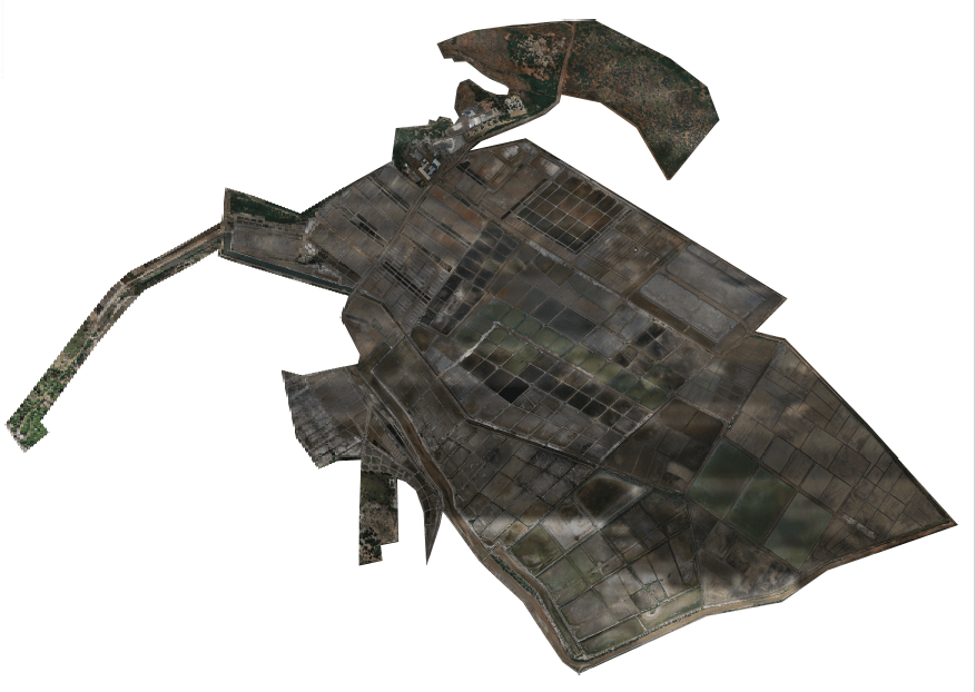
- Orthomosaic Image.
- Digital Surface model. (DSM)
- Digital Terrain Model. (DTM)
- Digital Elevation Model. (DEM)
- Point Cloud Data. (5 X 5 Mtr. Grid interval).
Get in Touch
Looking for a reliable partner for your next LiDAR survey?
Whether you’re working on infrastructure development, mining, urban planning, or environmental monitoring — we’re here to deliver accurate and cost-effective data solutions.
📞 Contact us today to discuss your project needs or request a free consultation.