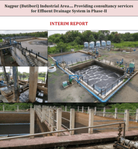
Project Background –
On north side of the Talegaon Industrial area Phase-II, there is hill and on south side of the area there is Jadhavwadi minor Irrigation Tank pond. As the area is situated on sloping ground of the hill, and area is subjected to heavy & intensive rainfall every year, it is necessary to provide proper storm water drainage system in the area to avoid flooding & ponding of the area. The area in Talegaon Industrial Area Ph-II are allotted to multinational units like M/s Emersion, M/s Vitesco, M/s Jushi, M/s Peri etc. and many units have completed their plant erection work and gone into production and many units are in construction phase.
Scope of Work –
1) Reconnaissance survey for Talegaon Industrial area Phase-II and around to observe outside and within project area.
2) Collection of Rainfall data of last 30 years from Indian Meteorological Department.
3) Analysis of Rainfall data and generate IDF (Intensity Duration Frequency) Curve.
4) For Runoff co-efficient, refer CPHEEO Manual and IRC codes for Industrial, Residential and Agriculture area.
5) Work out Flow and Explore Diversions if required along ROW of existing and proposed roads.
6) Hydraulic Design in Bently Software used and work out velocity, sizes of drains and inlet levels.
7) Cost estimates, Drawings and Preparation of DPR and recommend construction in phase manner.
Collection and Analysis of Rainfall Data –
Represent the detail of rainfall intensity from 1991 to 2021. The rainfall data is collected from Indian Metrological department. The maximum rainfall intensity is observed 253 mm/day.
Hydraulic Design –
Trials with StormCAD Bently Software has been taken for Return period 1 year (188.50 mm), 2 year (217.61 mm) and 5 year (263.11 mm). Looking to economy point of view, 1-year return period is considered for recommendation to work out sizes of Storm Water Drains. Most of nallas have been proposed to divert within ROW so depth of cuttings is from 1 to 9 meter due to proposed along reverse slope
Rainfall Intensity –
As the available rainfall data is in the form of daily rainfall figures, the method of using daily maximum rainfall depths in a year is proposed to be used. Gumbel’s Extreme Value Type-I distribution, is most commonly used for IDF relationships. This method is adopted here for development of IDF curves. (Ref: Lecture29Notes-ntpl by Prof. P.P. Mujumdar, Dept. of Civil Eng, II Serence, on Stochastic Hydrology. Refer nptl.ac.in/ courses/ 105108079/ module6/ lecture29pdf).
PRELIMINARY SURVEY & INVESTIGATION:
General – The Engineering survey has been carried out for the proper planning and design of Storm Water Analysis and Design of storm water Drainage system. Following surveys
have been carried out:
Topographical Surveys – The basic objective of the topographic survey was to collect the essential ground features of Nalla, roads, existing CD work Details etc. The data collected will result in the final design Storm Water Analysis and Design of storm water Drainage system.
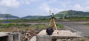
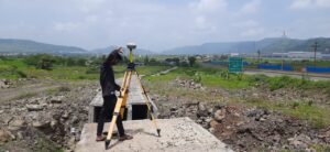
Detailed Survey of Topographical Features – Topographic survey is carried out using Differential Global Positioning System (DGPS) for detailed mapping and traversing. As part of the survey, the following activities were carried out.
(i) Bench Mark: As first step of the survey, Temporary Bench marks fixed by MIDC are considered. Details are given below.
(ii) The detailed cross-sections have been taken for full land width of roads at 20m interval for road length of 15Km.
(iii) The Detailed L-sections are drawn.
(iv) The outside catchment area is marked on Topo sheet to work out design discharge.
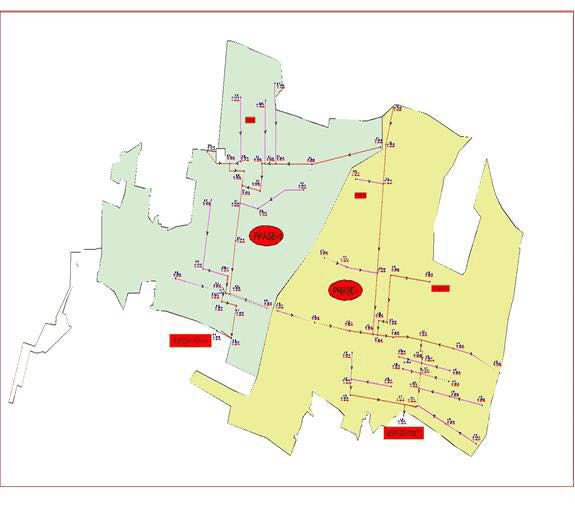
Contour Map – The detailed contour map of Phase II area is as below. As per the topography of the area, two drainage districts are proposed on East & West Side. The highest elevation of East Side is RL=707.00 M and the RL of disposal point is 647.00 M. The highest elevation of West Side is RL=698.00M and the RL of disposal point is 654.00 M. The area on East side is 276.00 Hect. And the area on West side is 198.00 Hect. In addition to above outside catchment area is 121.00 Hect. The general slope of area is towards south side of Phase-II.
Topographical Surveys –
The basic objective of the topographic survey was to collect the essential ground features of Nalla, roads, existing CD work Details etc. The data collected will result in the final design Storm Water Analysis and Design of storm water Drainage system.
Detailed Survey of Topographical Features –
Topographic survey is carried out using Differential Global Positioning System (DGPS) for detailed mapping and traversing. As part of the survey, the following activities were carried out.
(i) Bench Mark: As first step of the survey, Temporary Bench marks fixed by MIDC are considered. Details are given below.
(ii) The detailed cross-sections have been taken for full land width of roads at 20m interval for road length of 15Km.
(iii) The Detailed L-sections are drawn.
(iv) The outside catchment area is marked on Topo sheet to work out design discharge
FINAL PROPOSAL
4.1 Silent Features – As per the topography of the area, two drainage districts are proposed on East & West Side. The highest elevation on East Side is RL=707.00 M and disposal point is at RL
647.00 M. The highest elevation on West Side is RL=698.00M and disposal point is at RL 654.00 M. The area on East side is 276.00 Hect. and the area on West side is 198.00 Hect. In
addition to above outside catchment area is 121.00 Hect. The general slope of area is towards south side of Phase-II.
Proposal of Storm Water Drainage System –
We have considered the outside catchment area and catchment area within industrial area. It is now proposed to construct two main RCC Drain starting from upstream side of plot of M/S Emerson. One drain will go directly on south side with collecting storm water from adjoining area. The second drain will go from east side to west side and then it will run towards south side.
We have also studied two options to construct RCC Drain, with considering rainfall intensity 188 mm for 1 Year return period and time of concentration is considered for 5 minutes.