Project Details
This project report presents a complete study and design process for the proposed roadway development, covering various technical and environmental aspects. It includes the project’s introduction, site observations, topographical surveys, geotechnical investigations, design sheets, and final drawings prepared as per relevant engineering standards.
Introduction
The introduction section provides an overview of the project scope and objectives. It explains the need for the road development and highlights its role in improving regional connectivity, transport efficiency, and socio-economic growth. The project aims to enhance infrastructure by ensuring safe, durable, and cost-effective road design solutions.
Site Details: This section presents the location details, site layout, terrain characteristics, and accessibility. The site description forms the foundation for further survey and design activities.
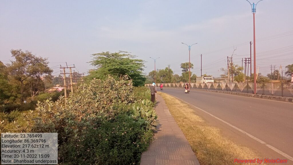
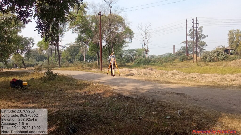
Site Observation: Observations made during field visits are summarized here, including soil condition, vegetation, drainage pattern, and man-made structures. These findings are essential for accurate survey and design interpretation.
Preliminary Investigation
This section covers all the investigations conducted before the design stage to assess the feasibility and challenges of the project.
- Topographical Surveys
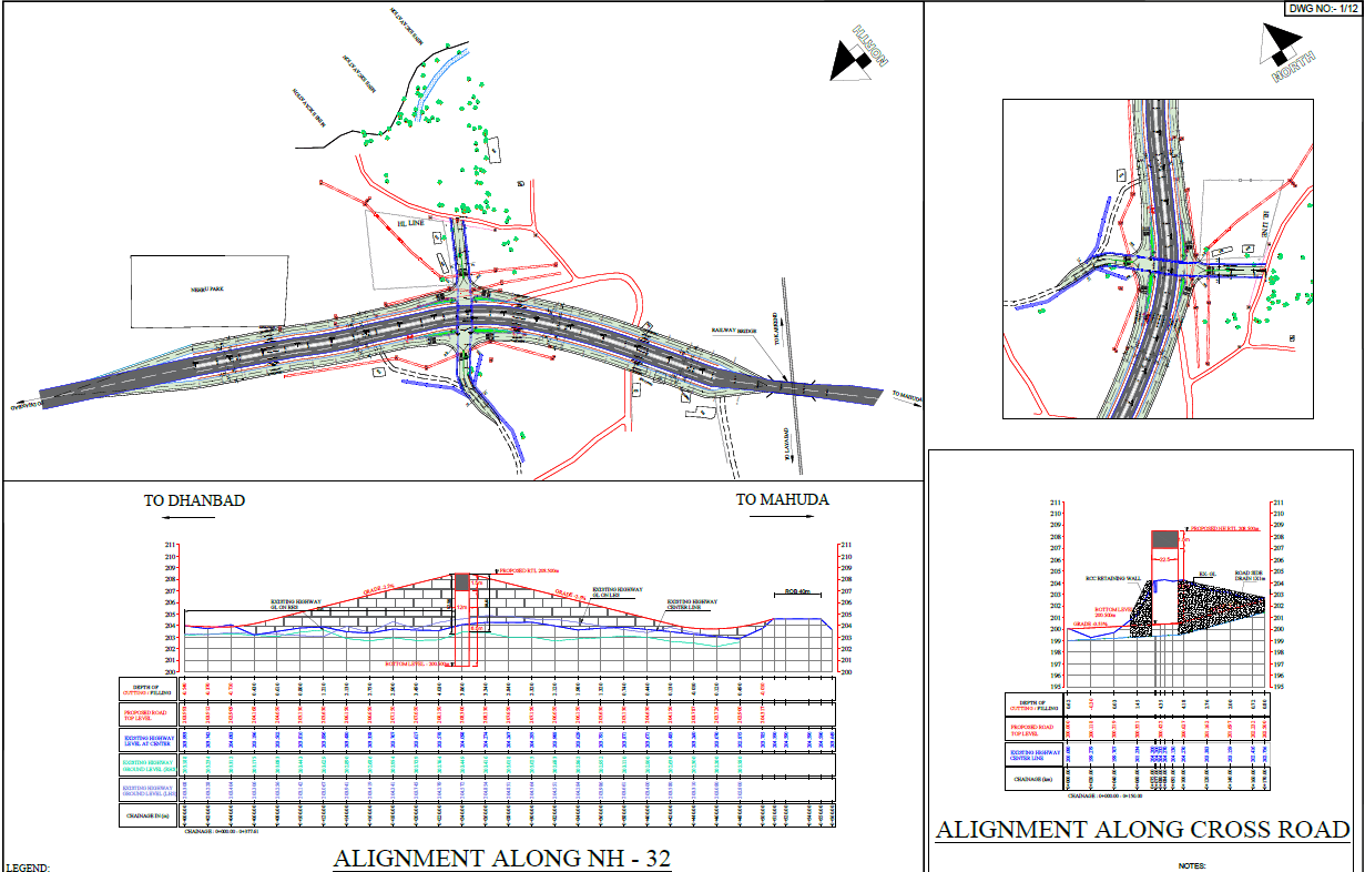
The topographical survey provides accurate details of the existing ground features, natural formations, and man-made structures. This data is critical for alignment design and level determination.
- Detailed Survey of Topographical Features
A detailed analysis of all features such as roads, buildings, utilities, water bodies, and vegetation is documented. The survey data helps in planning drainage systems, cross-sections, and geometric designs.
Road Features
This chapter focuses on the geometric and structural elements of the proposed road.
Road Land Width, Roadway, Carriageway & Cross-Sectional Elements
Details of the existing and proposed road geometry are provided, covering the following aspects:
- Road Land Width – Defines the total width of land acquired for the road, including shoulders, drains, and embankments.
- Roadway Width – The overall surface width available for vehicular movement.
- Carriageway Width – Specifies the main portion of the road used by moving traffic.
- Gradients for Road – Includes slope design for effective drainage and vehicle safety.
- Cross-Sectional Elements – Encompasses shoulders, side drains, medians, and slopes, ensuring structural stability and safety.
Geotechnical Report
The geotechnical investigation includes borehole data, soil classification, and analysis of subgrade strength. The findings determine the suitable pavement type and thickness design. Laboratory and field tests provide insight into soil bearing capacity, moisture content, and compaction properties, ensuring the structural integrity of the road foundation.
CBR Test Report
California Bearing Ratio (CBR) tests are conducted to evaluate the strength of the subgrade soil. These test results are vital for determining pavement layer thickness in flexible and rigid pavement design.
Traffic Report
Traffic studies include volume counts, vehicle classification, speed studies, and growth rate analysis. This data helps in forecasting future traffic loads, designing appropriate pavement thickness, and ensuring adequate capacity for projected demand.
Cost Estimate
The cost estimate section includes detailed calculations of material quantities, labor, machinery, and overhead costs. It provides a realistic projection of project expenditure and assists in budgeting and financial planning.
Design Sheets
All structural and pavement designs are documented here as per Indian Road Congress (IRC) and Ministry of Road Transport & Highways (MoRTH) guidelines.
- Crust Design – Flexible Pavement: Layer-wise design based on CBR values and expected traffic load.
- Crust Design – Rigid Pavement: Analysis and design of concrete pavement using stress and deflection criteria.
- RCC Design of Substructure and Foundation: Includes the design of footing, pier, abutment, and pile foundations.
- RCC Design of Superstructure and Bearing: Covers girder design, deck slab, and bearing arrangements for load transfer.
- RCC Design of Retaining Wall: Structural design to retain soil along embankments and cuttings.
Drawings
The final section includes all engineering drawings essential for execution and review.
- Topographical Survey Drawings – Represent existing site conditions and levels.
- Typical Cross Sections – Illustrate road layers, shoulders, and drainage components.
- General Arrangement Drawings (GAD) – Show overall layout, alignment, and structural configurations.
This project report represents a complete approach to road design, starting from preliminary investigations to final construction drawings. The integration of topographical, geotechnical, traffic, and structural studies ensures a robust and sustainable road infrastructure design. The project stands as a model of technical precision, planning, and engineering excellence.